


Technology Innovations Aid in Predicting & Preventing Wildfires
From satellite imagery and AI-driven models to advanced early-detection systems and innovative firefighting equipment, technology is providing the tools needed to address the growing wildfire threat more effectively.
NOTE: The views expressed here are solely those of the author and/or interview subject and do not represent positions of IEEE. Some references may require subscription to access content.
Wildfires pose an increasing threat to ecosystems, property, and human lives worldwide. They are not only environmental catastrophes but also economic disasters whose impact can affect local and national economies. The economic impact of wildfires is multifaceted, including immediate response costs, property damages and agricultural losses, healthcare impacts, and long-term recovery efforts. Proactive investment in wildfire prevention, early detection, and community resiliency is crucial to protect both lives and livelihoods.
As fire seasons become more frequent and severe, advanced technologies have evolved to assist in the capacity to predict and prevent wildfires, thus transforming the ability to combat these natural disasters.
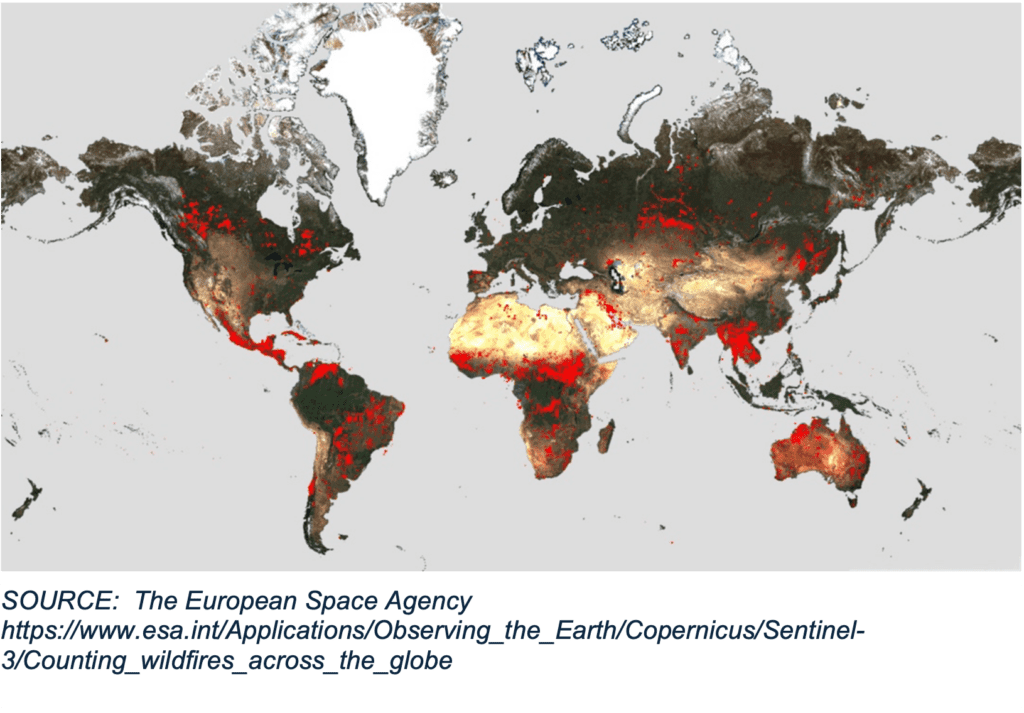
One of the most significant advancements in wildfire prediction is the use of satellite imagery and remote sensing. Satellites equipped with sophisticated sensors can monitor vast areas of land in real time, detecting changes in vegetation, moisture levels, and thermal anomalies that could indicate the early stages of a wildfire. Agencies like NASA and the European Space Agency (ESA) operate satellites that provide crucial data for wildfire prediction models.
In their paper, “Near Real-Time Wildfire Detection in Southwestern China Using Geo-Kompsat-2A Geostationary Meteorological Satellite Data [ 1 ],” published in IGARSS 2023, the authors describe using remote sensing combined with data such as slope, aspect, land cover, and acquisition time to develop a forest algorithm to build a wildfire monitoring model.
Machine learning (ML) and artificial intelligence (AI) are revolutionizing wildfire prediction by analyzing massive datasets to identify patterns and forecast fire behavior. AI algorithms can process historical weather data, vegetation types, topography, and previous fire occurrences to predict where and when a wildfire might start. Researchers and engineers are developing AI models that improve in accuracy over time. These models can predict fire spread patterns, giving firefighters and emergency responders critical information to make informed decisions.
Southern California EDISON has deployed a Public Safety Power Shutoff (PSPS) system to temporarily shut off power during dangerous weather events based on data gathered from fire scientists and meteorologists. These scenarios are becoming more prevalent.
Advanced weather-prediction models play a crucial role in wildfire forecasting. A variety of fire models exist, considering detailed data, including wind speed, temperature, precipitation, and humidity. This information is vital as weather conditions significantly influence fire behavior. Development in improving the accuracy of these models is ongoing, with results increasing the ability to predict when and where a fire may start [ 2 ]. These predictions help in assessing the risk of wildfires and in strategizing response efforts.
 Early detection is key to preventing wildfires from spreading. Technologies like infrared cameras, ground-based sensors, and drones are becoming increasingly common for monitoring vulnerable areas. Infrared cameras can detect heat signatures from small fires that might be invisible to the naked eye, enabling quicker response times.
Rapid mapping and real-time fire monitoring can inform intervention or management solutions to maximize beneficial fire outcomes. Drones equipped with thermal imaging cameras [ 3 ] can cover large areas, providing critical data to firefighting teams. These drones can fly over difficult terrain, where traditional surveillance methods might be challenging, and relay information about potential fire outbreaks.
Technology is also aiding in more effective forest-management practices, such as controlled burns. Controlled burns, or prescribed fires, are intentionally set under carefully controlled conditions to reduce the amount of flammable vegetation. These practices help decrease the intensity and spread of potential wildfires.
Advanced mapping and modeling tools help land managers plan and execute controlled burns more safely and efficiently. By simulating fire behavior [ 4 ] under different conditions, these tools ensure that controlled burns are conducted with minimal risk to surrounding areas.
Effective communication with the public is crucial for protecting life and property. Modern technology has enhanced community alert systems, providing real-time updates and warnings to residents in fire-prone areas. Mobile apps, automated phone calls, and social media platforms can disseminate information quickly, ensuring that people are aware of evacuation orders and safety protocols.
Additionally, wireless alerting systems send geo-targeted alerts to smartphones [ 5 ], informing residents about imminent wildfire threats. These alerts are especially useful for remote communities where communications systems are insufficient. The alerts are crucial for timely evacuations and preparedness.
Firefighters are also seeing technological advancements that are improving the tools and equipment they use. Modern firefighting vehicles are equipped with GPS and communication systems that enable better coordination during wildfire incidents. Robotic systems and unmanned ground vehicles [ 6 ] are being explored for firefighting in hazardous conditions. These robots can operate in environments that are too dangerous for human firefighters, applying water or fire retardants directly to the source of the fire.
Dr. Jagannath Nalavade, Associate Professor at the Department of Computer Science Engineering at the MITADT School of Computing in Pune, India, and a member of the IEEE Young Professionals Climate and Sustainability Taskforce, says that even though current technical advancements offer strong tools for predicting and preventing wildfires, there are still a number of challenges to overcome. Some of the most important challenges are integrating data from many sources, guaranteeing the precision and reliability of predictive models, and reducing the high expenses connected with implementing cutting-edge technologies. Future studies and development should focus on strengthening the prediction models’ accuracy, increasing the interoperability of various technologies, and making these innovations more cost-effective and accessible.
The integration of technology in predicting and preventing wildfires is a game changer in fighting against devastating natural disasters. From satellite imagery and AI-driven models to advanced early-detection systems and innovative firefighting equipment, technology is providing the tools needed to address the growing wildfire threat more effectively. As these technologies continue to evolve, the ability to safeguard lives, property, and natural ecosystems will also improve, leading to a safer and more resilient environment.
Additional resources:
[1] H. Zeng and B. He, “Near Real-Time Wildfire Detection in Southwestern China Using Geo-Kompsat-2A Geostationary Meteorological Satellite Data,” IGARSS 2023 – 2023 IEEE International Geoscience and Remote Sensing Symposium, Pasadena, CA, USA, 2023, pp. 3391-3394, doi: 10.1109/IGARSS52108.2023.10283079.
[2] J. Kuzmanova, M. Gusev and V. Zdraveski, “Calculating the Fire Weather Index for US wildfires using a GPU,” 2020 43rd International Convention on Information, Communication and Electronic Technology (MIPRO), Opatija, Croatia, 2020, pp. 260-264, doi: 10.23919/MIPRO48935.2020.9245199.
[3] X. Chen et al., “Wildland Fire Detection and Monitoring Using a Drone-Collected RGB/IR Image Dataset,” in IEEE Access, vol. 10, pp. 121301-121317, 2022, doi: 10.1109/ACCESS.2022.3222805.
[4] Rui Wang, Bin Chen, Fengru Huang and Yu Fang, “Using collaborative virtual geographic environment for fire disaster simulation and virtual fire training,” 2012 20th International Conference on Geoinformatics, Hong Kong, 2012, pp. 1-4, doi: 10.1109/Geoinformatics.2012.6270339.
[5] D. T. Jesalva, “WiNDAS: Wireless Natural Disaster Alert System,” 2021 IEEE Region 10 Symposium (TENSYMP), Jeju, Korea, Republic of, 2021, pp. 1-6, doi: 10.1109/TENSYMP52854.2021.9550993.
[6] K. A. Ghamry, M. A. Kamel and Y. Zhang, “Cooperative forest monitoring and fire detection using a team of UAVs-UGVs,” 2016 International Conference on Unmanned Aircraft Systems (ICUAS), Arlington, VA, USA, 2016, pp. 1206-1211, doi: 10.1109/ICUAS.2016.7502585.