More than a month after Berkeley’s plan for radiation testing in Cesar Chavez Park was rejected by regional water quality regulators, the city has submitted a new proposal that involves flying a drone over the park with the help of UC Berkeley nuclear engineering experts.
The city’s proposed testing regime includes partnering with UC Berkeley’s Nuclear Engineering Department to fly a drone with a radiation detection system over the landfill-turned-park, according to documents obtained by Berkeleyside.
The revised plan was written by longtime city contractor SCS Engineers and submitted on behalf of the city on Monday.
Blair Robertson, a spokesperson for the San Francisco Bay Regional Water Quality Control Board, wrote in an email to Berkeleyside on Tuesday that staff from the agency plan to review the plan “this week” but did not elaborate further. Once approved by the water board, the city will have 90 days to follow through with the plan.
The proposed testing comes over a year after the water board first received records from the Department of Toxic Substances indicating Stauffer Chemical Company disposed of hazardous radioactive waste and pesticides — including now-banned DDT and dieldrin — from 1960 to 1971 at the municipal dump beneath what’s now Cesar Chavez Park.
In January, the water board ordered the city of Berkeley to come up with a plan for testing soil and groundwater for both radiation and pesticides at the park by April.
The city complied, and in April submitted a plan that among other things called for an inspector carrying a field analyzer to walk around the park in an “S” shaped path, taking measurements while following long lines along the ground spaced 100 feet apart.
In a May letter rejecting the city’s proposal, water board Executive Officer Eileen White wrote that the agency had consulted with a health physicist with the California Department of Public Health and found the proposed scanning method to be inadequate because it would have allowed for “excessively high” background radiation levels at the park. The city was given a deadline of July 1 to revise and resubmit the plan.

“The proposed initial surface scan method … is not adequate because it would result in a significant portion of the site not being surveyed,” White wrote at that time. “A comprehensive surface scan should cover 100 percent of the landfill surface, or as close to that as possible, recognizing that walkover access may be inhibited by vegetation in some portions of the site.”
In a May off-agenda memo to the Berkeley City Council, outgoing City Manager Dee Williams-Ridley characterized the required testing as “precautionary” and said the city has “met all regulatory requirements.” Berkeley spokesperson Seung Lee said officials had received Berkeleyside’s request for more information on the new plan, but would need more time to answer the publication’s questions.
The newly proposed plan fixes the problems raised by the water board by instead flying a drone over the park. The drone survey “aims to cover 100% of the accessible ground surface, providing a comprehensive assessment of the site’s radiological condition,” the plan reads.
If approved by the water board, a drone would suspend a 3-by-3-inch sodium iodide spectrometer roughly 3 meters above the ground and take measurements every 6 meters in the park. The spectrometer would be capable of detecting radiation levels as low as 0.05 micro-roentgens per hour. Roentgens are a unit of exposure from X or gamma rays.
Background radiation in the environment — which comes from cosmic rays and other naturally-occurring radioactive materials contained in the earth and in living things — typically ranges from 5 to 20 micro-roentgens per hour, according to the U.S. Department of Energy.
The city plans to also use a handheld radiation detector at “select locations” to validate the drone data, according to the currently proposed plan.
According to the proposed plan, UC Berkeley will process the drone survey data and cross-check it with the ground survey data.
Brian Quiter, the deputy head of the Lawrence Berkeley National Laboratory’s Applied Nuclear Physics program, and Kai Vetter, a professor of nuclear engineering at UC Berkeley, were both copied on the city’s updated work plan. Neither Quiter nor Vetter immediately responded to Berkeleyside’s interview requests.
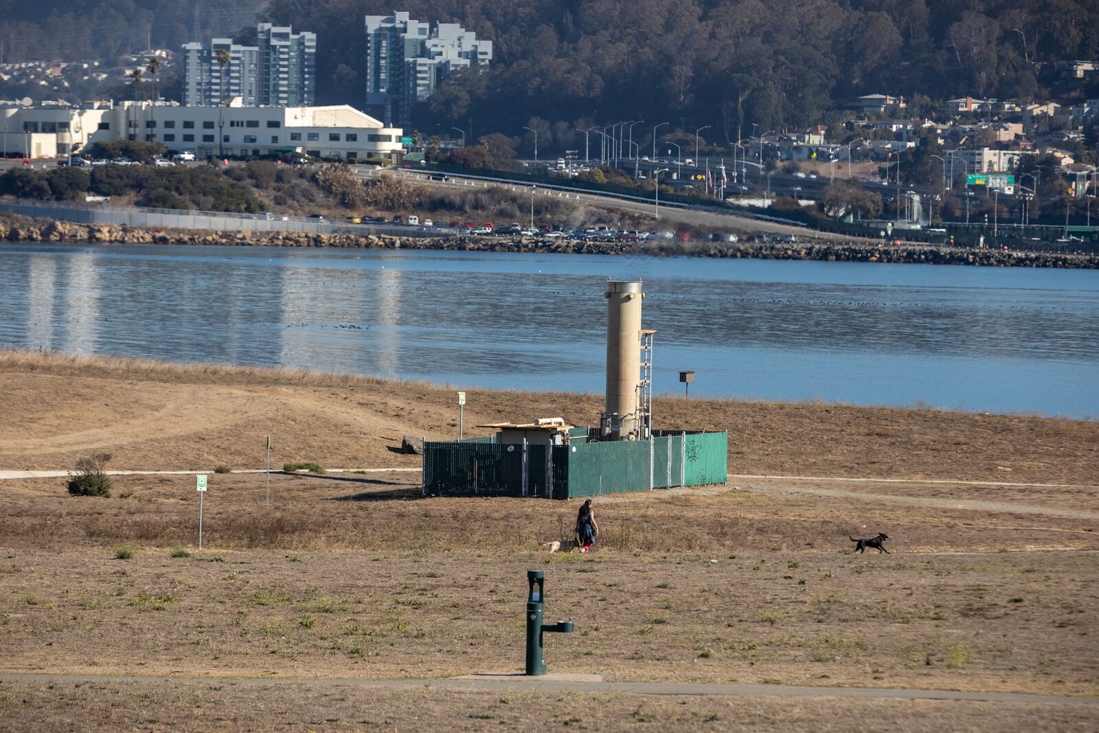
Decades-old radiation and toxic pesticides aren’t the only concerns plaguing the popular 90-acre park: From May to June, the park underwent a series of repairs ordered by the Bay Area Air Quality Management District in February to address allegations of air pollution from methane generated as trash in the old landfill rots, as first reported by Berkeleyside.
The alleged violations by the air district included allowing methane to leak into the air for more than two weeks and failures to operate a flare station meant to safely burn off the methane in the park for the required amount of days per year.